After a perfectly adequate breakfast, although when compared to my last two 'hostel' breakfasts it seemed rather meagre (!), I left the b&b and promptly returned to the porch as the light drizzle I'd wandered into required at least my Marmot Precip jacket. Five minutes down the road the intensity of the rain increased and it was clear I needed to fully suit up, so out came the Berghaus Deluge trousers. There's a climb out from Ogbourne up onto the ridge and it wasn't long before the rain stopped and I was able to remove my jacket.
However this wasn't to last too long, as just before I reached the ridge it was obvious that another squall was about to hit me, so before it did it was off with my fleece and on with the jacket, timed perfectly as a few minutes later came the heaviest (and last) rain I'd had to date. Half an hour later though the sun was out, and looked like it was here to stay so it was waterproofs off again.
Today was only a short walk as I was being picked up by another daughter at 2pm, so not long before I was able to see the finish, just at the end of this track
Sign at the beginning (the end for me) of the Ridgeway
Well that's it. Ridgeway completed East to West. Now I just have to wait to be collected.
Reflections:
I'm glad I did it but would I do it again? Probably not. Whereas the Pennine Way draws me back the Ridgeway doesn't, and I found nothing along the route that was really a 'wow' factor. For those not wishing to walk the full 88 miles I much preferred the 'original' Ridgeway between Overton Hill and Streatley, as it was more of a ridge walk compared to the part between Streatley and Beacon Hill.
I was lucky with the weather, 2 hours wearing waterproofs in 6 days given the recent weather was far better than I'd expected.
Overall the route is well maintained and although some sections currently are a tad muddy, most of it is well maintained and offers good safe walking.
There are few convenient rest stops along the route, so anyone doing it should be prepared to either carry snacks etc for lunch, or simply skip it.
Ridgeway February 2014
Thursday 20 February 2014
Wednesday 19 February 2014
A day the miles flew by ...
After another great breakfast I headed out to what was promised as a fine day, and so it turned out. Leaving the hostel behind
it's a short walk up the A338 to rejoin the Ridgeway. I had a 19 mile walk ahead of me today, but the miles just seemed to fly by, clearly my legs are getting used to walking day after day. I seem to remember it was the same on my Pennine Way walk, with days 1 and 2 going OK but feeling tired on day 3, then steaming ahead from day 4 onwards.
Some fine views ...
Though a bit misty as I reached the crossing with the B4001
An obsolete ladder style
Further on past White Horse Hill you come to Wayland's Smithy long barrow, with a useful information board
The path at that point as fairly muddy but cross into the wood that runs parallel to it and there's a dryer, and less used, path
Lots of pig farms in this part of the world, these three came to see me
Shortly afterwards you pass the distinctive 'Nells Hill'
From there it's a short walk to cross the M4, and a climb to the final ridge before descending into Ogbourne St George. On the outskirts of the village I pass the 'The Inn with the well' pub, which I discovered later really does have a well in it, covered by a glass floor. Quite strange standing in a pub and looking down into a well! Unfortunately it was closed, opening at 4, so I booked into my b&b, changed and then headed back for a pint for two. Superb end to what had been another great day.
Tuesday 18 February 2014
Duck is broken ... my waterproof jacket comes out
Breakfast this morning was the best, and largest, that I've ever had in a hostel, I think the guy cooking it took pity on me as a) rain was forecast today (little did he know I'd successfully dodged it to date) and b) I was the only one booked for breakfast. Whatever the reason I got 2 eggs, fried bread, hash browns, bacon, sausage, baked beans and mushrooms ... and he even made me my mugs of tea!
From Streatley I was anticipating a change in the Way, as it was at this point I joined the original 'Ridgeway', before it was extended to Beacon Hill. So it proved as the paths became wider, more time was spent on the high ground and there were generally magnificent views over the surrounding countryside.
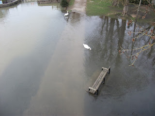
However my luck didn't hold, and an hour after starting the first rain appeared, not heavy and only requiring my waterproof jacket, which came off about an hour later as the clouds passed. I did though have to cross a flooded portion of the track as I dropped off one ridge before climbing the next, thankfully not deep enough to cause any real difficulty and this time my feet stayed dry.
Reaching the next ridge, the clouds parted to reveal more blue sky
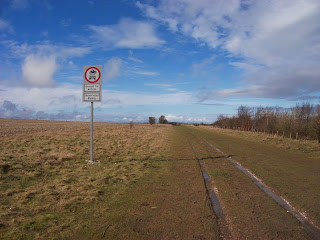
and after crossing the A34 I came across the first of many signs prohibiting traffic on the Ridgeway in an attempt to limit the damage done by those intent on driving the green lanes.
with later on a good view down to Didcot power station, creating its own cloud.
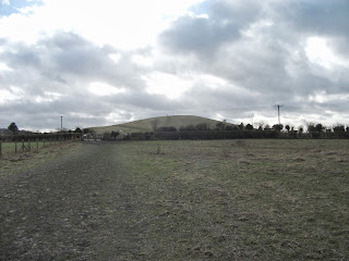
I don't know who Scutchamer was but apparently his knob is that way
and it's not that pretty a sight
One of the many trees I came across blown over by the recent storms
Later on a large herd of deer crossed the path
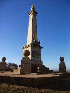
Shortly afterwards I reached the memorial to Brigadier Robert James Loyd-Lindsay, 1st Baron Wantage, VC KCB (17 April 1832 – 10 June 1901) who was a British soldier, politician, benefactor to Wantage, one of the founders of the British National Society for Aid to the Sick and Wounded in War latterly called the British Red Cross Society, for which he crucially obtained the patronage of Queen Victoria, and a distinguished philanthropist and luminary of Victorian society. It was just before here that I was convinced a huge black cloud was going to dump on me, but it passed safely to the South of me
but for some reason my GPS went crazy here, no doubt in my mind caused by the cloud. Weather forecast had predicted hail so I suspect there was hail in the cloud, as rain doesn't affect GPS signals
Soon I arrived at Court Hill Centre, previously a Youth Hostel but now run privately, where I was to stay that evening. It also has a tea room for those walking past, and I can recommend the flapjacks and the leek and potato soup!
Today had definitely been the best walking day so far with great views, and generally fine weather, and it got better when I discovered I had the whole hostel to myself! How they covered their costs I have no idea, but I was provided with unlimited tea and even fresh milk in the fridge, an evening meal and a huge breakfast all for £27.
The wooden beams
My TV room
My dining room
Monday 17 February 2014
Three in a row ... another dry day
Well a good night at my daughters and a short'ish day today, 14 miles to the Youth Hostel at Streatley. It was planned to be 16 but as I posted earlier the Thames path is flooded so I have to turn off the Ridgeway short of Wallingford where it meets the Icknield Way/Swans Way and follow that route into Goring. Loaded with a good breakfast and a cheese, ham and pickle baguette in my sac (my daughter insisted I took something for lunch though I normally just snack) I was dropped where I'd been picked up the previous day.
Thankfully after only another mile 'down off the ridge' the Way turns left and heads once more to the hills. Added to that the fact that now the hordes of 'walkers', both of the dog variety and others, from the previous 2 days had now disappeared I was beginning to enjoy the walk again. Also gone was the blue sky of the day before, but I seemed to miss the rain that was apparently due, and so experienced another dry day, 3 in a row!
Still masses of Red Kites about, and at one point I counted 11 above me, before I stopped for lunch at the Holy Trinity church at Nuffield.
Shortly after leaving there the Way follows the line of Grims Ditch, the origins of which seem unclear.
At the end of Grims Ditch, or at least that portion of it, I turned West to head along the Icknield Way to Goring, unfortunately not as scenic as the Thames path would have been, and a bit of a 'road slog' at times, but at least it wasn't under water. Arriving at Goring I could see for myself the flooding that had closed the Thames path.
Taking advantage of my earlier than planned arrival I popped into the local tea shop, and had a tea and cornish pasty, and a very tasty one too, definitely worth a stop for anyone doing the Way. Still far too early for the YH to be open, I headed for the John Barleycorn pub and allowed a couple of pints to while away the remaining time!
Sunday 16 February 2014
Second day ...
Today looked like being a glorious day as the sun shone through my bedroom window. I had a long'ish day ahead of me, nearly 19 miles, and was being collected at the end by one of my daughters, who as she lives in Reading had been convinced she needed to put me up for the night. After a large breakfast I was away by 9am. Weather was pretty much perfect with a completely blue sky as I left Wendover and crossed an empty A413 (well it was early on a Sunday).
There's a bit of a climb up to Coombe Hill, and I paused half way up to grab the first of many geocaches that I would find along the way. On the top of Coombe Hill there's an imposing memorial to the Boer War, built in 1904.
Also here I met the first of the hordes of dog walkers and others out sampling the lovely weather. As someone who generally craves solitude when walking it wasn't my idea of an ideal day and secretly I was praying for a return of the rain to help drive them all away.
Another of the many signposts evident along the route.
The walk goes through Chequers which is quite imposing, and you have to smile as there are some seriously impressive CCTV systems around, wonder why!
What was noticeable now was the number of Red Kites flying around, they seemed everywhere but my puny camera wasn't good enough to get any decent photos of them.
Time for a rest!
The end of today was probably the most boring part of the route. From Chinnor to the point where I was to be collected, it's around a 7 mile slog that seems pretty much straight, and was probably also the wettest part I'd encountered so far. All made worse by the fact the route at this point is 'off the ridge', which was tantalising close and about half a mile South of me, oh how I longer to be up there instead. It was here I saw ahead of me a walker with a huge pack, god knows what he was carrying, and as I passed him it was clear he was struggling under the load. I never saw him again ... :-) Arrived at the pick up point at around 3.30 pm with damp feet, having had no option but to wade a flooded part of the track about an hour ago, although my tight fitting gaiters had kept out the worst of the water. Hoping for good weather tomorrow but after two dry days I'm not hopeful.
Saturday 15 February 2014
My first day ...
Well today didn't quite work as planned due to the storms of Friday evening damaging the rail line between Clapham Junction and Tring. I had been expecting to leave Worthing around 10am, change at Clapham Junction and be at Tring by 1pm having walked up from the station, where I would get a bus up to Beacon Hill after a swift pint in the local pub. Thanks to the delays I only reached Tring station just past 2pm, after a tortuous train journey.
I had 3 options, walk the 3 miles to Beacon Hill, only then to turn around and walk back to where I was (the train station is on the route), say to hell with it and just walk from here (so missing the first 3 miles) or get a taxi to the start so I was pretty much back on time. Never one to cheat I bit the bullet and took a taxi (rip off at £12 but had no choice). This put me at the start just before 2.30pm, so after a couple of quick pics just to show that I had made the start (!) it was time to be off!
The route was well signed and easy to follow, in fact the whole of the Ridgeway could be walked without a map it's so well signed. My aim was to be at my B&B in Wendover between 6 and 6.30, so with 12 miles to do in under 4 hours I needed to get a wiggle on. Thankfully, despite the rain in the previous weeks, the ground underfoot wasn't too soggy so swift progress could be made pretty much everywhere. I had loaded some geocaches that were along the route to my Etrex, but there were none on this first leg so nothing to distract me as I walked!
Looking back towards Beacon Hill
A lone walker ahead of me
A tree lined ride before Tring, where I was to pass the station I'd arrived at about 90 minutes ago!!
Bridge over the busy A41
Sure does seem peaceful here ...
The view from 'Peaceful'
Darkness was falling as I approached Wendover, so my headtorch was needed, not to see with but to help the motorists see me as the final bit wends its way along country lanes, rather appropriately to Wendover, where I booked into a lovely b&b run by a lady called Grace. Comfortable, spacious room, at 17 Icknield Close and listed on the Ridgeway website http://www.nationaltrail.co.uk/ridgeway/plan Having settled in and booked breakfast for 8, it was off to the pub for a well deserved pint or two, followed by a fish and chip supper from the local shop ... and then to bed.
Friday 14 February 2014
One day to go ...
Just packed my rucsac for my trip to Tring tomorrow. With fluids on board my Lowe Alpine 35l Airzone comes in at just under 10kgs.
Latest weather forecasts looking good, I should stay dry at least until Sunday night, which given the recent weather is a good result.
I'll try to add short notes to this blog as I go along, then expand on them and add a few photos once I get back. Wish me luck!
Latest weather forecasts looking good, I should stay dry at least until Sunday night, which given the recent weather is a good result.
I'll try to add short notes to this blog as I go along, then expand on them and add a few photos once I get back. Wish me luck!
Subscribe to:
Posts (Atom)